Yandex applications are becoming more and more popular every day. And almost half of Russia use mobile Yandex.Maps. But this popular program has features that are not known to everyone. These interesting options will make orientation in the city even easier, and using the application is much more convenient. That's what we’ll talk about today.
Content
General functions of Yandex.Maps
This application has existed in the information space since 2004. At first, it was not particularly popular and was much inferior to Google maps. The utility offered to familiarize oneself with the user's environment:
- not very well-drawn buildings;
- View a possible route.
Later, the calculation of distances between waypoints along roads and route points was added. This began to attract drivers and travelers. Moreover, the cards cover not only the vastness of Russia, but apply to other countries:
- Belarus;
- Ukraine
- Georgia
- Israel;
- Kazakhstan;
- Poland
- Baltic States wholesale and other states of the continent.
Users of the mobile application have 4 options for maps:
- schematic image;
- satellite imagery;
- cards with signatures;
- popular routes - places marked by people as worthy of attention.
And in November 2016, the 3D display of buildings on Yandex.Maps began to work.
Find parking
Many large cities have parking problems: too many cars have divorced. To find a place where to stick the car, go to the "Parking" tab. There various colors will indicate possible options:
- blue - free parking;
- blue - paid parking;
- green - available places on the road.
Here, prices for paid parking per day or hour will also be displayed.
Choose a suitable bus
More precisely, not only the bus, but in general all types of ground public transport. This option is especially useful when visiting an unfamiliar city or for children who need to get to the other end of the village to a tutor or section.
In the appropriate tab, you need to indicate the departure and arrival points, then the options will be highlighted than how you can get there. And if you click on the stop icon on the map, the numbers and modes of transport that stop here will appear.
This card is dynamic. You can see in real time how buses, trolleybuses and trams move.
Find the entrance
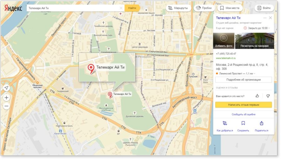
To find which side of the building the entrance is located, the corresponding option will help. You must enter the name of the object in the search bar, click on the label, and you will see in a panoramic view where exactly people enter.
The function is useful for taxi drivers, as well as for searching the entrance to shopping or entertainment centers.
find yourself
The "I" icon will help to determine your geolocation. Click on it and the exact address will appear along with geographic coordinates.
Study carefully all the utilities that are installed on your smartphone. It happens so informative!